Date: 20/08/2012
Time: 12:10 - 13:55 (11:10 - 12:55 GMT) and 18:15
- 19:25 (17:15 - 18:25 GMT)
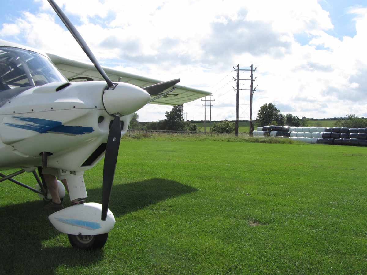
Aircraft: Ikarus C42 - G-CDMS
Lundy on a Monday
(and Newton Peveril and Dunkeswell)
OK, yes I know I have borrowed the title from someone
else, but it does fit. Ian and I have taken the day off work with the aim of
going to Lundy - a small island in the Bristol Channel, 10 miles off the Devon
Coast. I have wanted to go there for a long time and for once the weather seems
to be co-operating. We get the plane out, check it over and fuel it. We also
get a pair of lifejackets and the PLB that we part own. 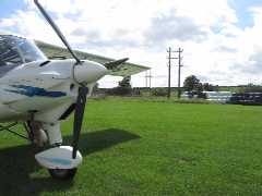 I
also want to get another letter for the AlphaBet
Challenge - I need an N, I have been to Newton Peveril before, but time
is running out before the challenge ends, so this is our first stop. It does
mean that the legs are rather uneven, but never mind.
I
also want to get another letter for the AlphaBet
Challenge - I need an N, I have been to Newton Peveril before, but time
is running out before the challenge ends, so this is our first stop. It does
mean that the legs are rather uneven, but never mind.
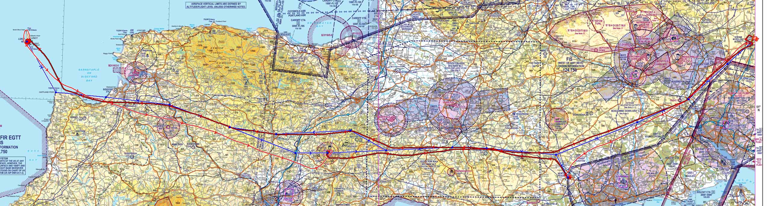
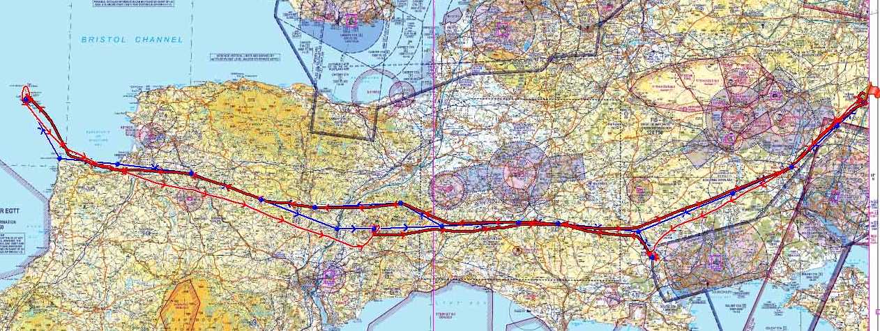
Ian has the first leg to Newton Peveril. We take
off on 21 and head straight down the gap between
Boscombe CMATZ and the Southampton zone then straight towards Tarrant Rushton,
then just round the corner of Bournemouth zone under to 2000' airspace step.
We join downwind and land on 27. Only a small break here to stretch our legs
and recheck the aircraft. The airfield owner comes over for a quick chat, but
soon we ready for the off. I call Lundy and I'm told it's OK to come in, but
there's lots of sheep on the runway. We don our lifejackets ready for the water
crossing.
 My
turn in the left seat for the big leg to Lundy. My initial route is north-ish
to Blandford Forum to avoid the Weymouth Paralympics zone with a good margin.
Past Hermatage, Sutton Bingham Reservoir, Crewkerne and Chard. Then to Culmhead,
past Tiverton, round Eaglescott and past Belle Vue, where we stopped last time
we were in this area. Then onto Bideford Bay and follow the coast round past
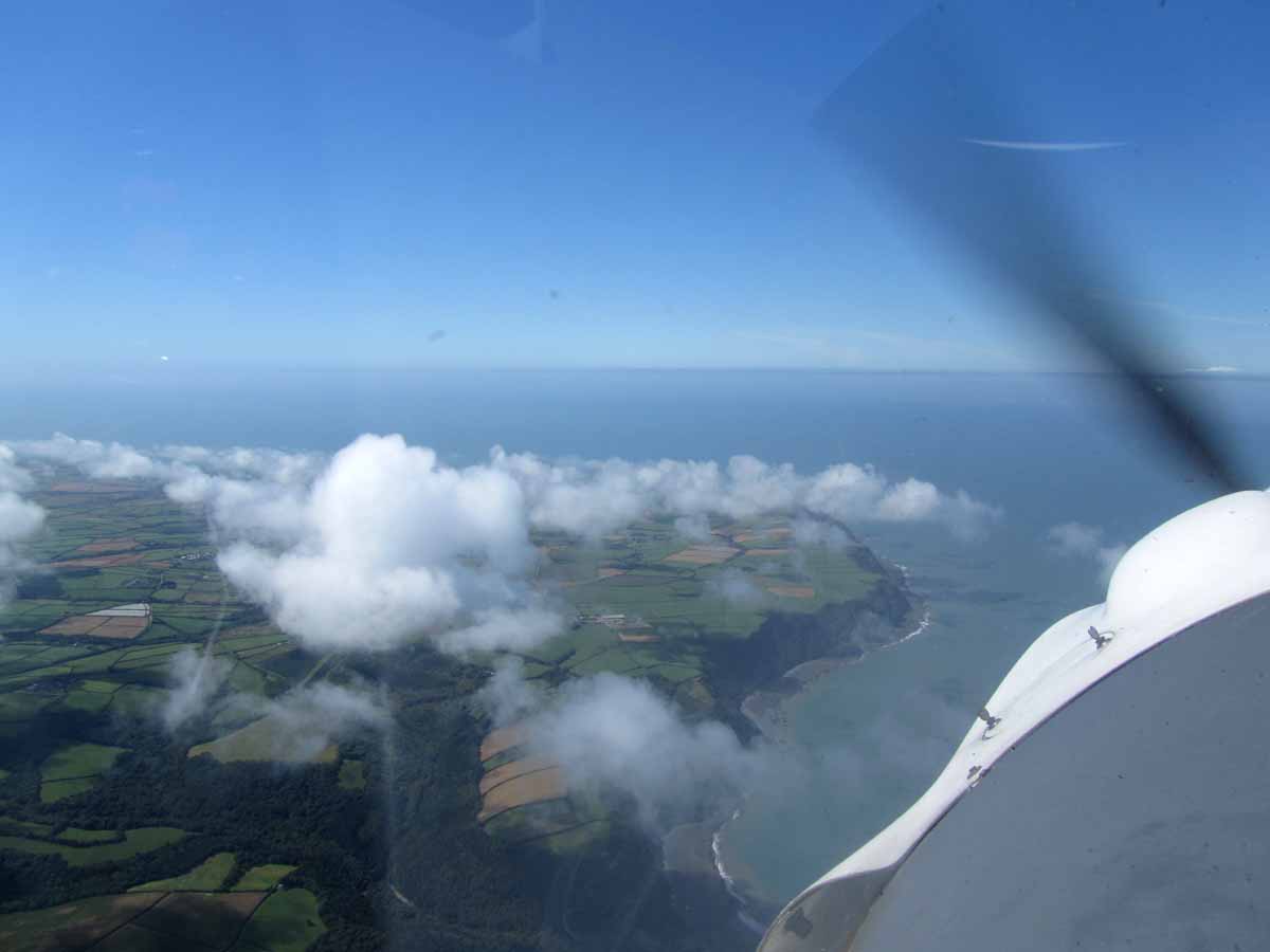
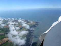
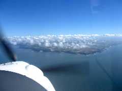
Clovelly to Hartland Point. From here we can now just see the island - the visibility
isn't bad. There is a fair amount of low level of clouds, so I climb above them
before coasting out and heading north over the water at about 4000'.
My
turn in the left seat for the big leg to Lundy. My initial route is north-ish
to Blandford Forum to avoid the Weymouth Paralympics zone with a good margin.
Past Hermatage, Sutton Bingham Reservoir, Crewkerne and Chard. Then to Culmhead,
past Tiverton, round Eaglescott and past Belle Vue, where we stopped last time
we were in this area. Then onto Bideford Bay and follow the coast round past
Clovelly to Hartland Point. From here we can now just see the island - the visibility
isn't bad. There is a fair amount of low level of clouds, so I climb above them
before coasting out and heading north over the water at about 4000'.
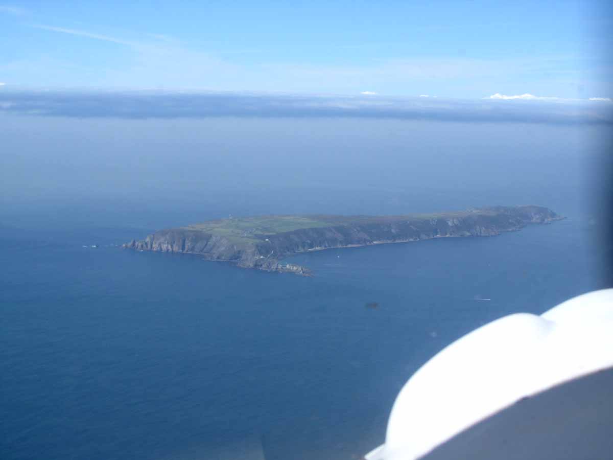
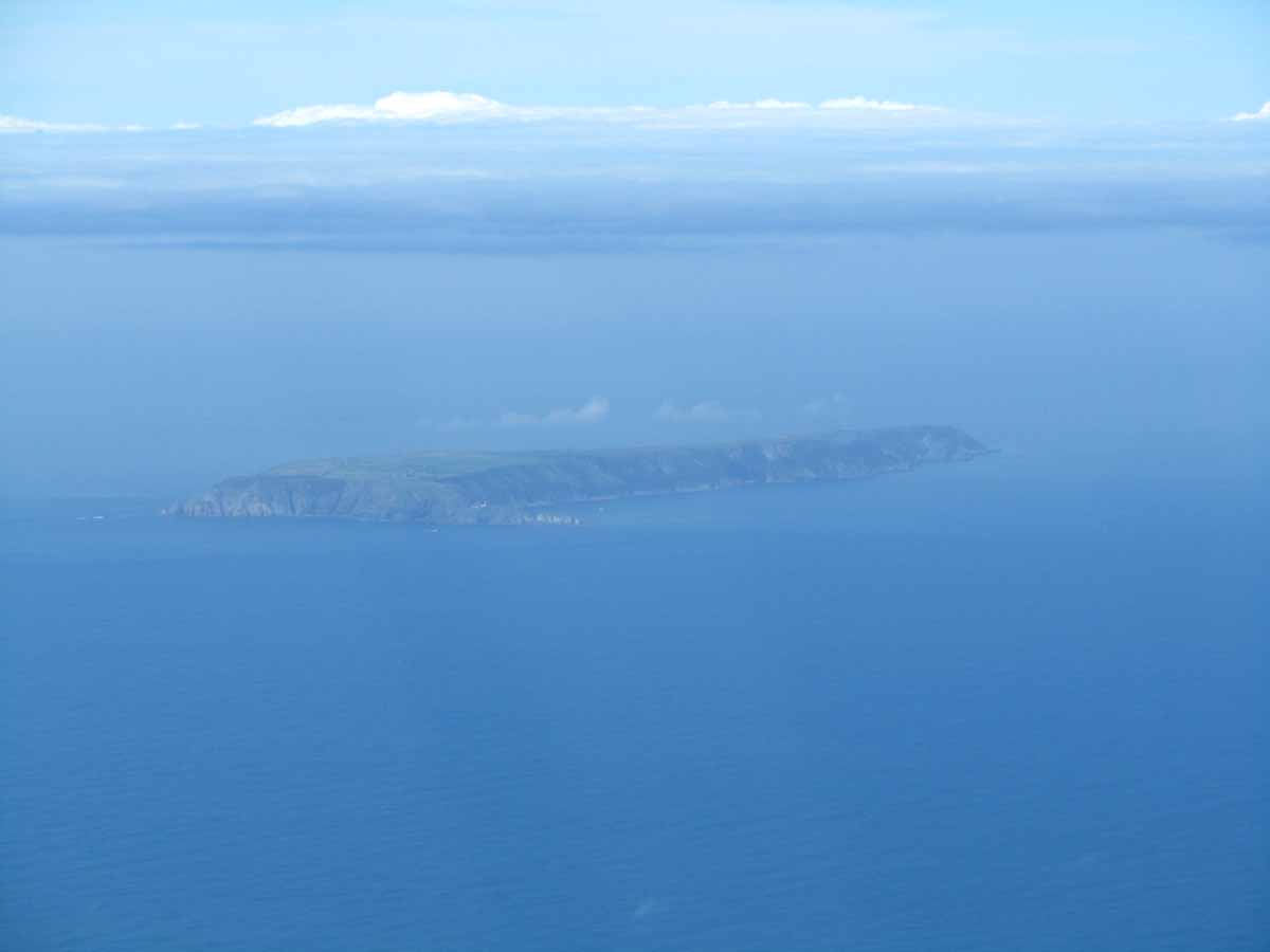
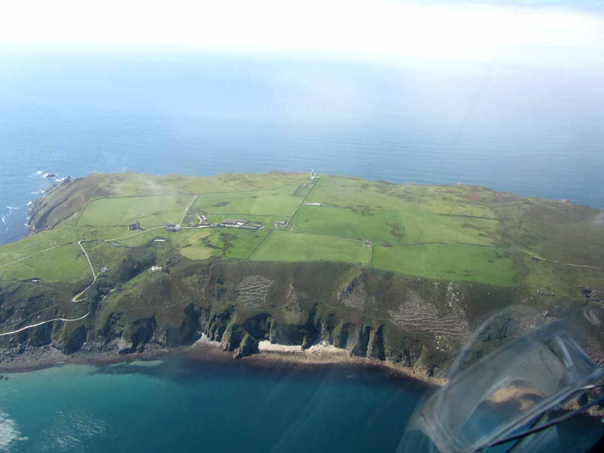
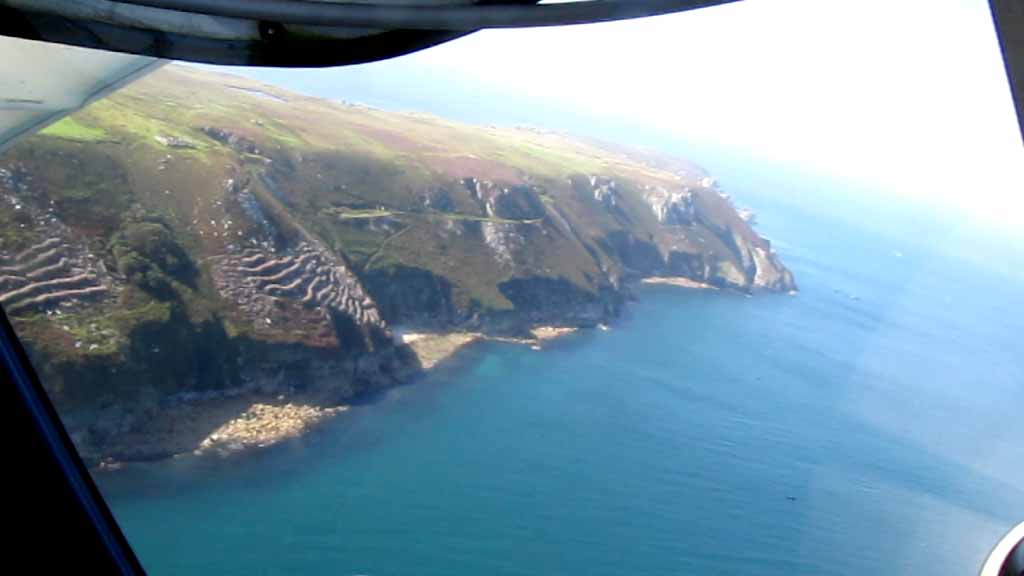
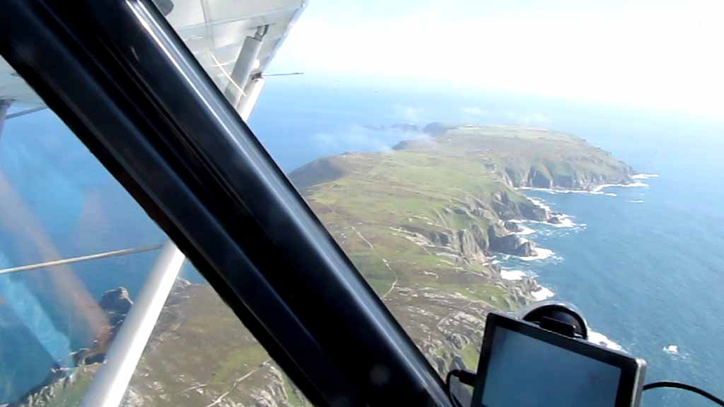
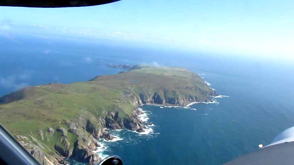
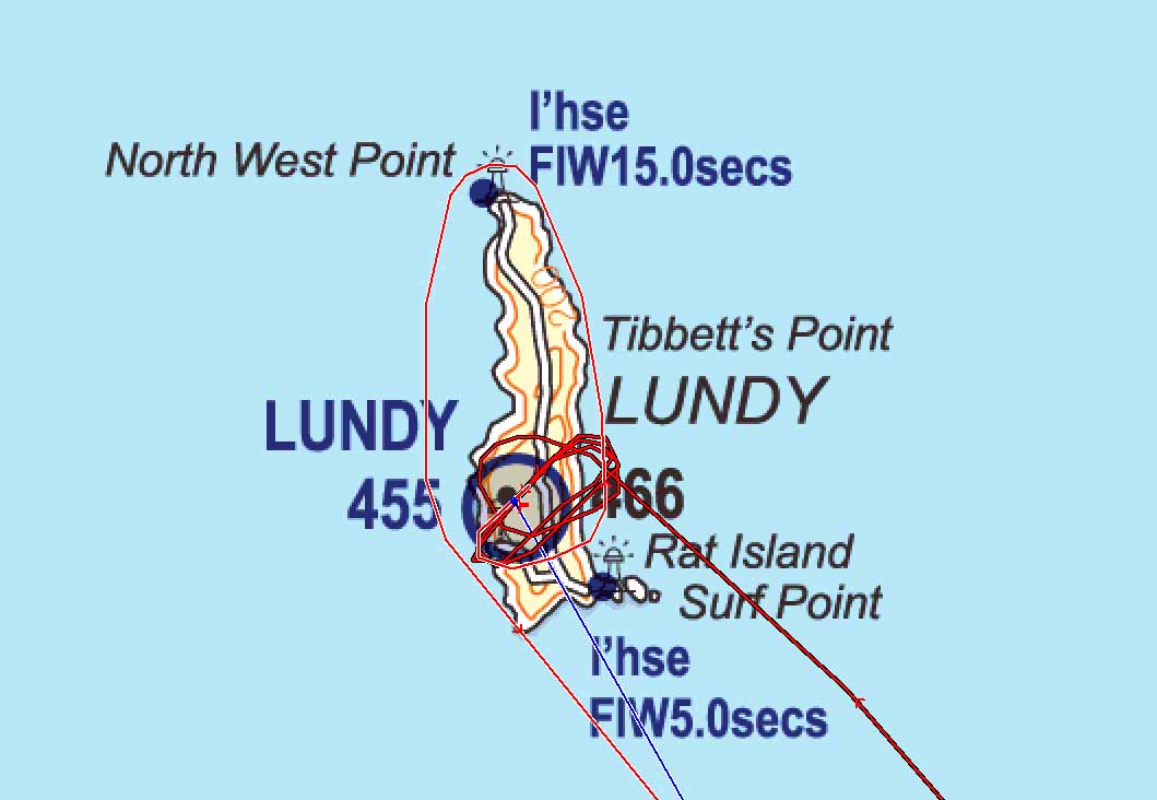
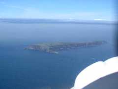
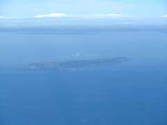
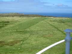
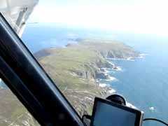
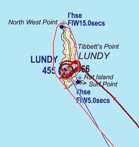
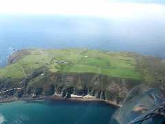 The
long thin island comes into clearer view and when we arrive we can see that
the runway is indeed covered in little woolly blobs. Joining overhead for 24,
I then approach to do a low pass (as instructed) to attempt to scare the sheep
off. This shows the undulations in the airstrip where it is initially uphill,
then flattens in a dip.
The
long thin island comes into clearer view and when we arrive we can see that
the runway is indeed covered in little woolly blobs. Joining overhead for 24,
I then approach to do a low pass (as instructed) to attempt to scare the sheep
off. This shows the undulations in the airstrip where it is initially uphill,
then flattens in a dip. 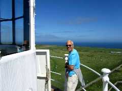
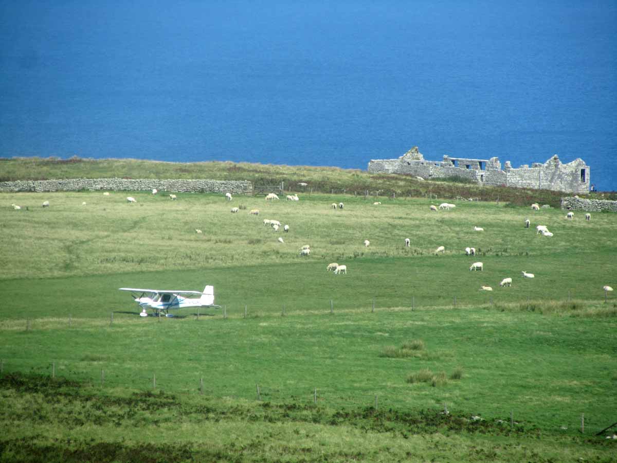
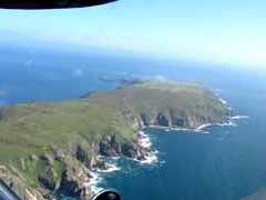
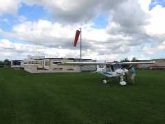
 Round
the circuit and it is clear there is still too much lamb on the runway, so we
do another buzz (lower) over the runway.The next time round they haven't had
time to reconverge and I land on the first uphill section which we are told
is in better condition than the rest. We taxi carefully watching for rocks and
holes and park off to the south.
Round
the circuit and it is clear there is still too much lamb on the runway, so we
do another buzz (lower) over the runway.The next time round they haven't had
time to reconverge and I land on the first uphill section which we are told
is in better condition than the rest. We taxi carefully watching for rocks and
holes and park off to the south.
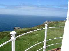
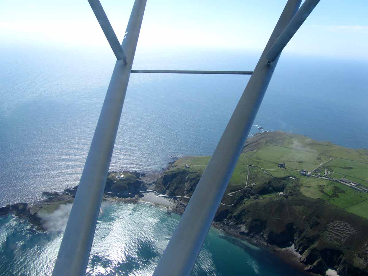
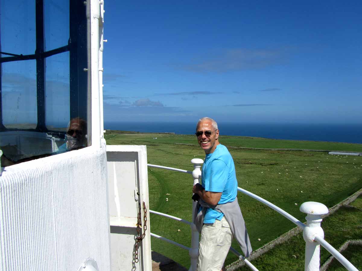
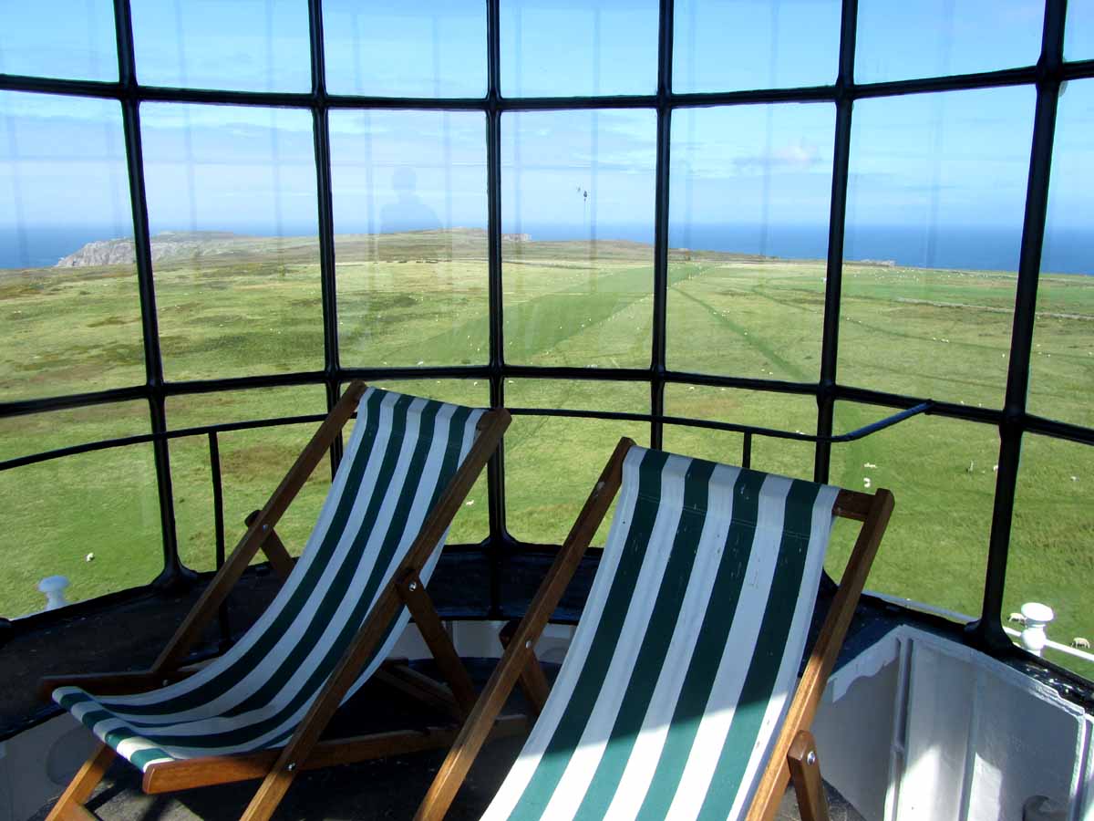
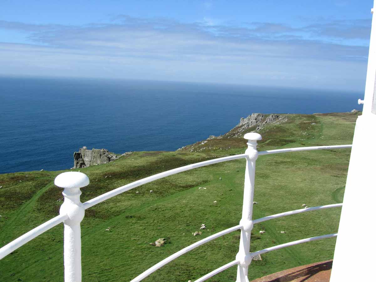
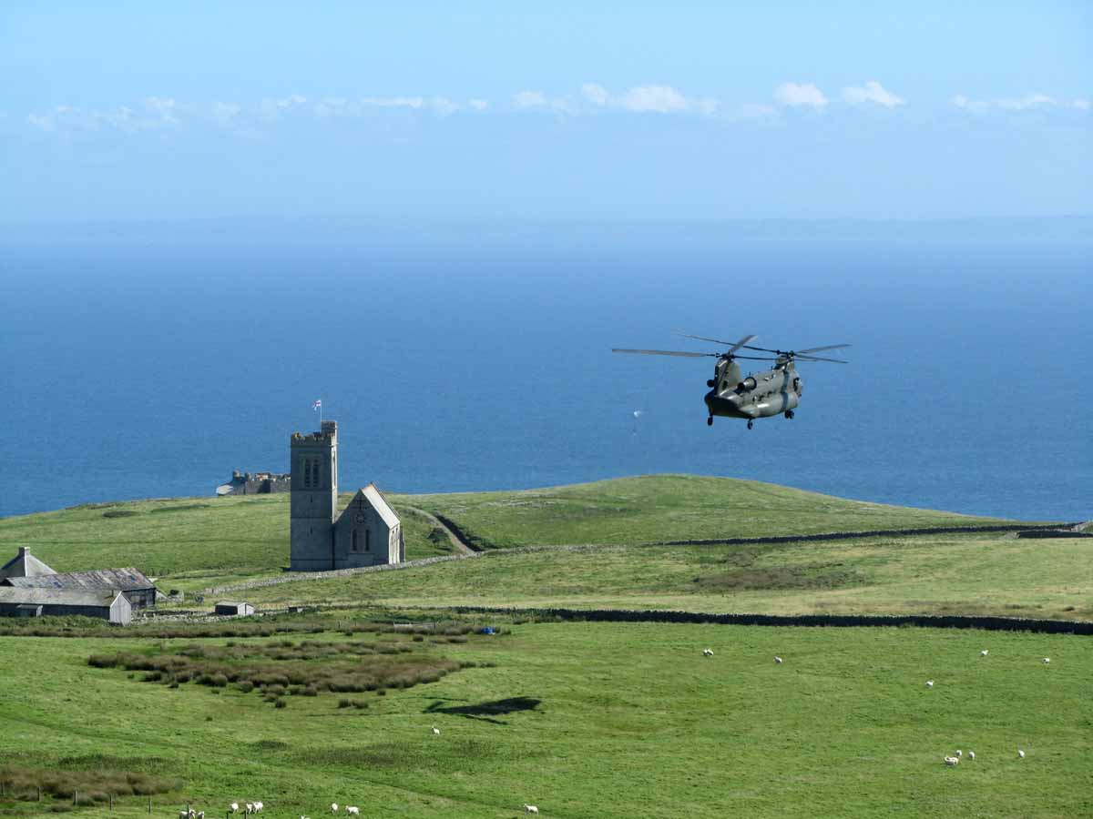
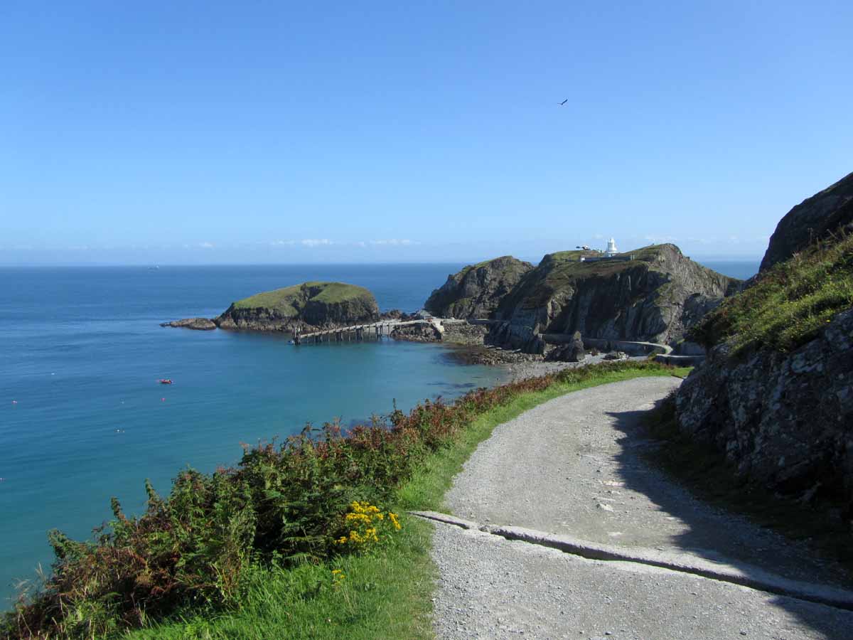
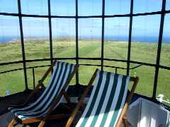
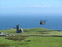
 We
tie the plane down and then walk up to the lighthouse as it seems the closest
habitation. It's open to visitors and we go up to the (disused) lantern - there
are some fantastic views from up here. The island looks somehow a bit bleak
but very beautiful. A Chinook helicopter arrives and orbits the south of the
island (including the lighthouse) and then puts down near the church - I can't
see if anyone has been dropped off or collected, but they soon lift and depart
back to the mainland.
We
tie the plane down and then walk up to the lighthouse as it seems the closest
habitation. It's open to visitors and we go up to the (disused) lantern - there
are some fantastic views from up here. The island looks somehow a bit bleak
but very beautiful. A Chinook helicopter arrives and orbits the south of the
island (including the lighthouse) and then puts down near the church - I can't
see if anyone has been dropped off or collected, but they soon lift and depart
back to the mainland.
 We
then wander to the tiny village and find
the pub, where we have to sign in and pay for our landing - £15 for the
plane and £5 for each occupant (unless you happen to be a National Trust
member). Sadly, we are too late for cooked food, so we get some tea/hot chocolate
and cake and consume this outside in the lovely sunshine.
We
then wander to the tiny village and find
the pub, where we have to sign in and pay for our landing - £15 for the
plane and £5 for each occupant (unless you happen to be a National Trust
member). Sadly, we are too late for cooked food, so we get some tea/hot chocolate
and cake and consume this outside in the lovely sunshine. 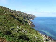
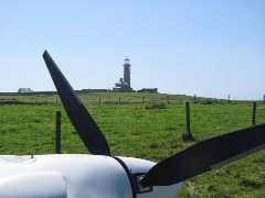
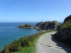 Time
for a walk; we walk down towards Harbour - the sides of the island are quite
steep but very pretty. Another helicopter is dropping off a load slung beneath
it, near to the (working) lighthouse, near Rat Island. We then head back to
look for the shop, but never really find it. We did look round the museum building,
and then head along the east side of the island, a little way past the threshold
of runway 24, then back to airfield.
Time
for a walk; we walk down towards Harbour - the sides of the island are quite
steep but very pretty. Another helicopter is dropping off a load slung beneath
it, near to the (working) lighthouse, near Rat Island. We then head back to
look for the shop, but never really find it. We did look round the museum building,
and then head along the east side of the island, a little way past the threshold
of runway 24, then back to airfield.
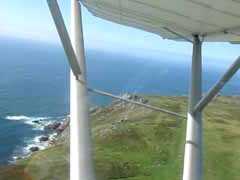
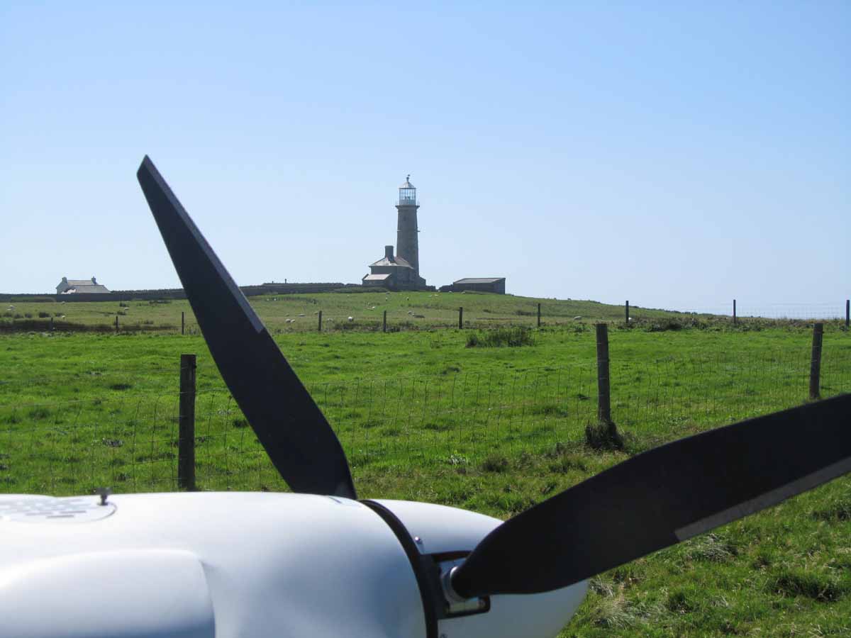
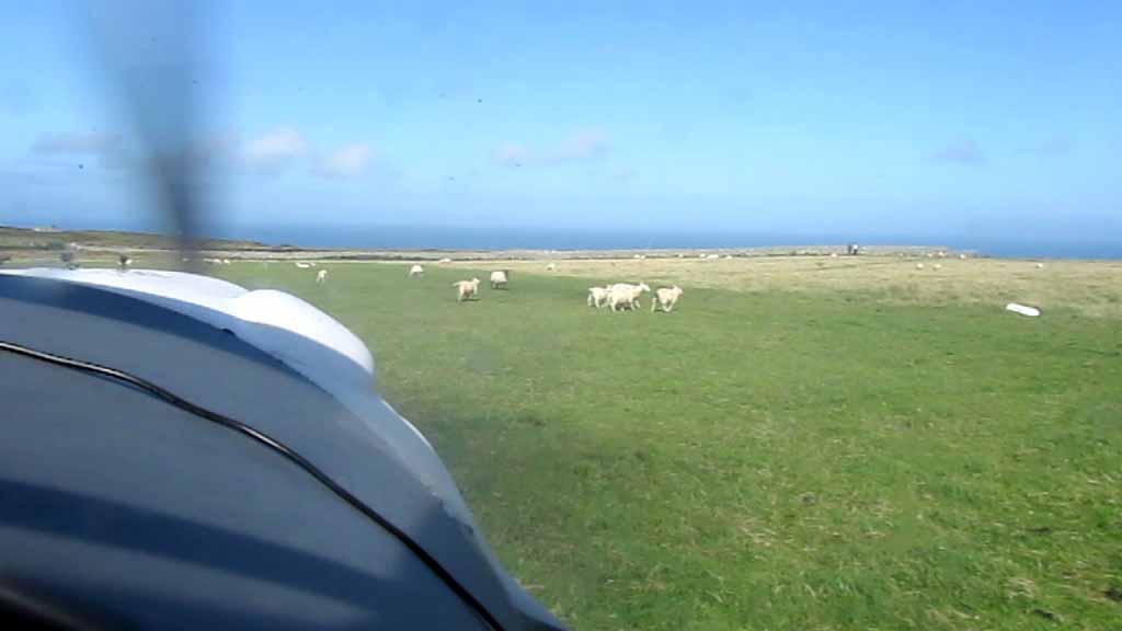
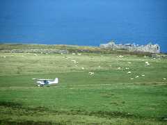
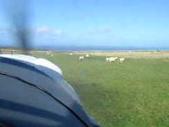 Quick
checkover and we're off again - this time with Ian flying us to Dunkeswell.
But the first problem is the flipping sheep. After warm-up, we taxi from the
parking area and head up the runway, then turn round back towards the threshold;
weaving left to right to chase the sheep away. No matter how hard you shout
"get out the way you woolly bastards" or "mint sauce", they
don't seem keen to move. A quick turn at the threshold before they drift back
and we take off along the left side of the runway - when we walked along it
previously this looked the smoothest.
Quick
checkover and we're off again - this time with Ian flying us to Dunkeswell.
But the first problem is the flipping sheep. After warm-up, we taxi from the
parking area and head up the runway, then turn round back towards the threshold;
weaving left to right to chase the sheep away. No matter how hard you shout
"get out the way you woolly bastards" or "mint sauce", they
don't seem keen to move. A quick turn at the threshold before they drift back
and we take off along the left side of the runway - when we walked along it
previously this looked the smoothest. 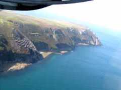
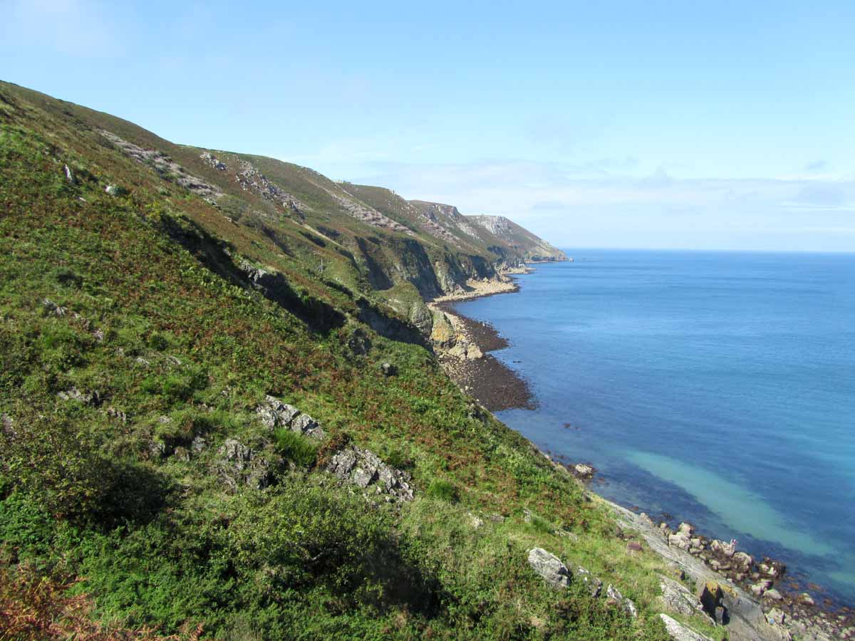
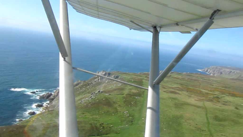
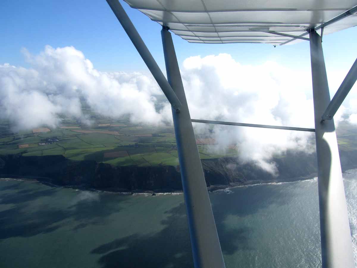
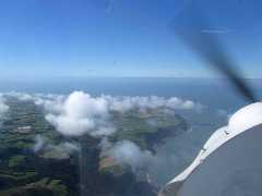
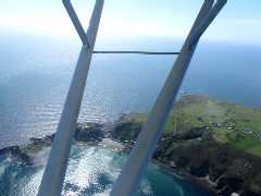
 The
uphill slope delays takeoff, but we are soon rising up and over the cliff edge
to the sea, before turning downhill. We then (as planned) fly round the islands
coast in an anticlockwise direction. At the north end of the island is another
lighthouse, where we turn south and along the west coast. It shows an excellent
example of how the (clear) moist air from
the Atlantic is pushed up by the island as it passes over it and condenses into
clouds.
The
uphill slope delays takeoff, but we are soon rising up and over the cliff edge
to the sea, before turning downhill. We then (as planned) fly round the islands
coast in an anticlockwise direction. At the north end of the island is another
lighthouse, where we turn south and along the west coast. It shows an excellent
example of how the (clear) moist air from
the Atlantic is pushed up by the island as it passes over it and condenses into
clouds. 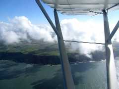
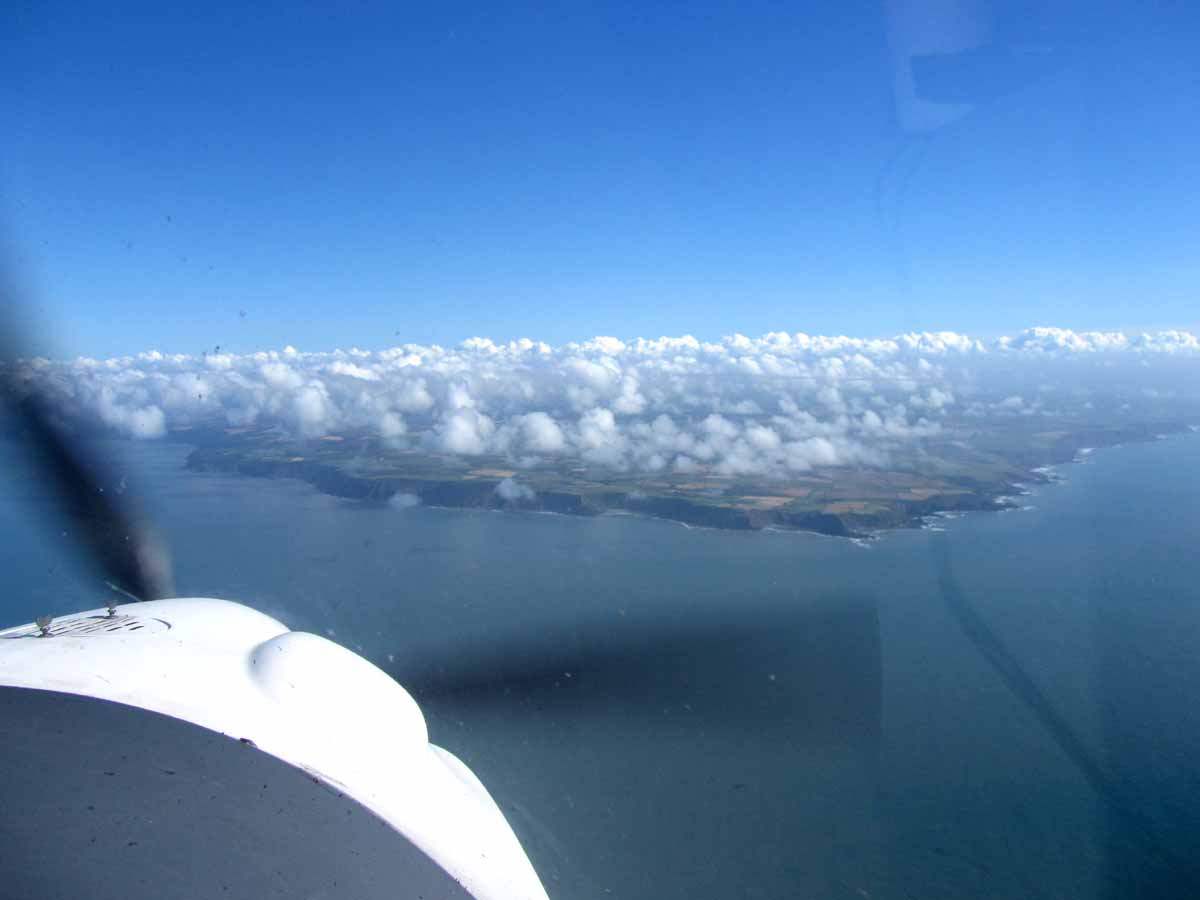
 These
then disperse as they fall off the other side and the air sinks back down. At
the south end we have gained some height and can see the Devon coast in the
distance. Nearing the mainland the clouds begin again (again condensing as the
air rises onto the land). Our route back to Dunkeswell is pretty similar to
the outbound but a little further south. Keeping clear of North Hill gliding
site, we join downwind for runway 22 due to the parachute jumping.
These
then disperse as they fall off the other side and the air sinks back down. At
the south end we have gained some height and can see the Devon coast in the
distance. Nearing the mainland the clouds begin again (again condensing as the
air rises onto the land). Our route back to Dunkeswell is pretty similar to
the outbound but a little further south. Keeping clear of North Hill gliding
site, we join downwind for runway 22 due to the parachute jumping.
 We
sign in and go to the cafe. Unfortunately, our quest for food was again thwarted
as we (apparently) had just passed the chef as he was leaving. We did manage
a couple of pre-made sandwiches and some tea. The new cafe does look quite smart
-just don't know how it tastes.
We
sign in and go to the cafe. Unfortunately, our quest for food was again thwarted
as we (apparently) had just passed the chef as he was leaving. We did manage
a couple of pre-made sandwiches and some tea. The new cafe does look quite smart
-just don't know how it tastes.
Another checkover and I'm doing the last leg home.
Again this is pretty much the same route as outbound - not surprising as it
is the most direct. A deadside join at Popham and land on 21.
Another lovely day out - frequently mentioning the
poor people at work today.
 Video clip of take off - click
here.
Video clip of take off - click
here.
Return to 2012 Index
Return to main Index
 I
also want to get another letter for the AlphaBet
Challenge - I need an N, I have been to Newton Peveril before, but time
is running out before the challenge ends, so this is our first stop. It does
mean that the legs are rather uneven, but never mind.
I
also want to get another letter for the AlphaBet
Challenge - I need an N, I have been to Newton Peveril before, but time
is running out before the challenge ends, so this is our first stop. It does
mean that the legs are rather uneven, but never mind.